Phoenix Weather Report for Dec 3rd, 2020
Forecaster: Henz, D
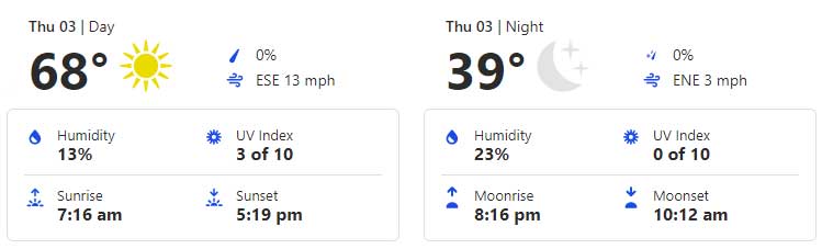
Today’s weather will be sunny with increasing winds (7-15mph range) before easing this afternoon for the Greater Phoenix Metro Area. Temperatures are expected to reach 68 degrees today. Tonight will be clear skies with a low of about 39 degrees. You’ll definitely want to keep pets and temperature-sensitive plants indoors.
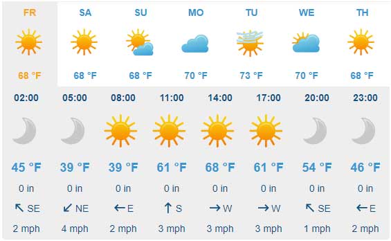
Moving ahead, high pressure will rebuild across the region over the weekend lending to warming temperatures into the start of next week.
After a chilly start to Friday, afternoon temperatures will again climb into the 65˚F-67˚F range around the Valley under mainly sunny skies. East/northeast winds will generally hover in the 3-8mph range with localized gusts around 10-15mph.
Overnight lows into Saturday morning will be rather chilly reaching the 30s for many rural areas. Plan on warming conditions over the upcoming weekend to go along with mostly sunny skies and dry weather conditions. Daily highs will return to the low 70s on Saturday before possible mid 70s on Sunday.
Air Quality Forecast
ADEQ Meteorologist: M. Pace
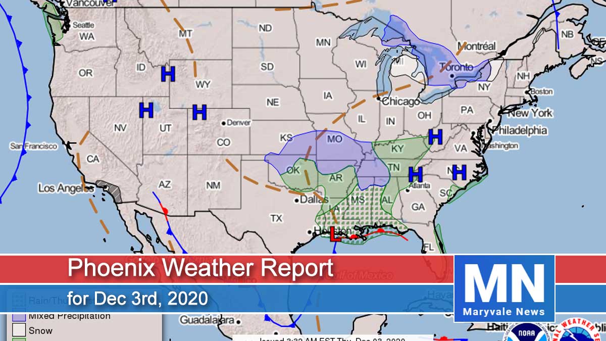
Satellite this morning shows a ridge of high pressure centered from western Montana back toward northern California. At the same time, an area of low pressure is moving south through Arizona. This set-up resulted in breezy to windy conditions overnight, with them continuing this morning. The strongest winds are located in the foothills north and east of the Valley, where 30-40mph wind gusts have been reported. Winds will weaken later this morning into the early afternoon.
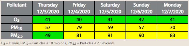
One benefit of these winds is improved air quality in the Valley. Winds overnight allowed for a weaker inversion to develop, plus they cleared out some of the built-up dust and smoke over the past several days. As a result, both PM-10 and PM-2.5 values are running lower this morning than yesterday morning.
This system also brought in much cooler air, with afternoon high temperatures today and tomorrow forecast to be in the mid to upper 60s! The other big weather story will be cold temperatures tonight into Friday morning. With clear skies and light winds, temperatures will drop into the 30s across the Valley tonight, with the low to mid-30 likely in the outskirts of the Valley.
Tomorrow through the weekend, high pressure will rebuild over Arizona, resulting in mainly clear skies, light winds, and warming temperatures. By Monday, afternoon high temperatures may be back in the mid-70s, which is well above average for this time of year.
As for air quality, with cool overnight lows in the forecast, along with light winds this weekend, expecting both PM-10 and PM-2.5 to increase starting tomorrow morning. The highest concentrations are forecast to be Saturday and Sunday due to increased fireplace/firepit use along with stagnant conditions. Right now, we will not be issuing any High Pollution Watches or Advisories; however, we will be watching trends closely.