Phoenix Weather Report for Dec 2nd, 2020
Forecaster: Henz, D
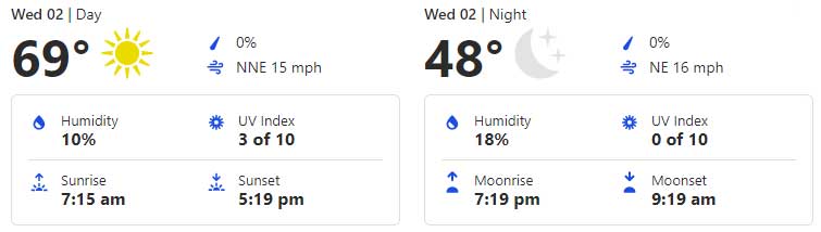
Today’s weather will be sunny with light winds,10 to 12mph, for the Greater Phoenix Metro Area. Temperatures are expected to reach 69 degrees today. Tonight will be clear skies with a low of about 48 degrees and wind gusts of 20 to 30mph.
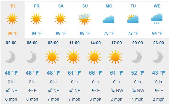
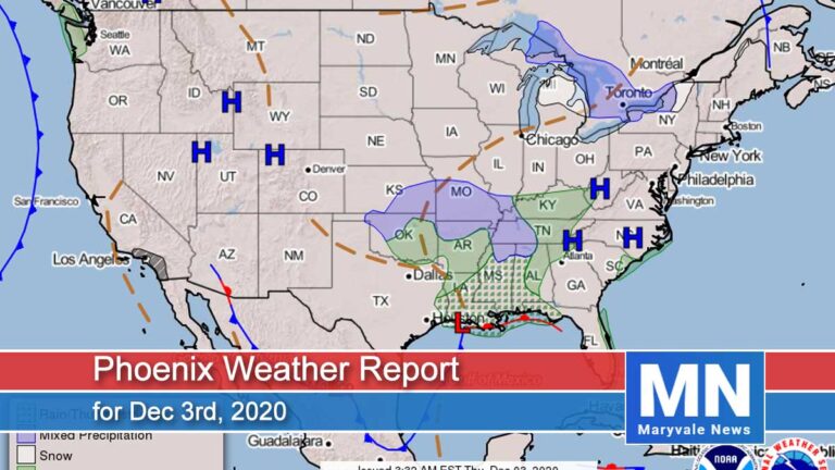
Looking at the big picture, our next weather disturbance is currently taking shape across the central Rockies before digging southwest into AZ overnight tonight into Thursday. Unfortunately, we won’t see any precipitation with this system instead the focus will be on breezy to windy conditions later tonight lasting through Thursday afternoon. Daily highs are expected to drop into the mid-60s for Thursday and Friday to go along with chilly overnight lows flirting with the freezing mark.
Plan on continuing windy conditions through Thursday morning with localized gusts reaching the 20-30mph range. Daytime highs will step back into the 65˚F-67˚F range around the Valley under mainly sunny skies. Winds will ease back into the light category by the evening hours before chilly overnight lows dipping into the low 40s to upper 30s across the lower deserts.
Heading into Friday, plan on highs lingering in the mid to upper 60s to go along with quiet and dry weather conditions.
Air Quality Forecast
ADEQ Meteorologist: M. Pace
It was another cold (for Phoenix standards) morning in parts of the Valley, with Phoenix Sky Harbor dropping to 44 degrees. Some locations in the W/SW Valley even dropped into the upper 30s. On the other hand, if you live in the foothills north and east of the Valley, you might have noticed some breezes this morning, which helped keep temperatures warmer compared to the heart of the city.
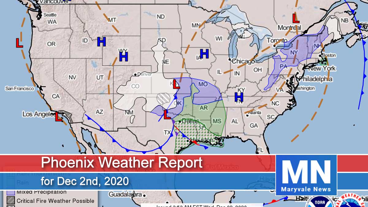
This morning, water vapor satellite shows an extensive storm system over the middle of the country with two areas of low pressure. One is near the Texas panhandle, with another moving through northwest Colorado. The low over Colorado will drop southwest and move into Arizona this evening before exiting the state into Mexico tomorrow afternoon. As this system approaches and moves through, forecasting northeast winds to increase into the 10-15mph range later this afternoon through the overnight hours, with stronger winds forecast in the foothills north and east of the Valley. Would not be surprised to see some isolated pockets of blowing dust across the southeast Valley; however, not expecting a widespread blowing dust event.
Unfortunately, this will be a very dry storm system, so no rain is in the forecast. And speaking of rain, with no measurable rain in the forecast today, it will make it the 104th consecutive day without rain at Phoenix Sky Harbor. This streak will likely continue increasing for at least another week as no rain is in sight. The record is 160 days set in 1972.
Even if this storm doesn’t bring us rain, it will bring some colder air with it, resulting in afternoon high temperatures dropping into the mid to upper 60s tomorrow and Friday.
This weekend into the first part of next week, overall high pressure will build into the entire Western United States. There are some indications that a couple of dry weather systems may try to move through the state, but for the most part, expect mostly clear skies, lighter winds, and temperatures warming back into the low to upper 70s (well above the average for this time of year).
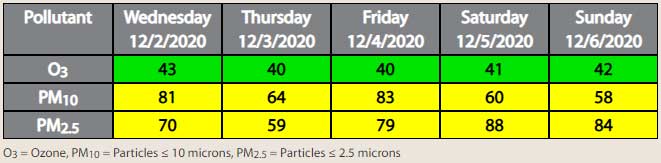
As for air quality, with breezes tonight into tomorrow morning, forecasting both PM-10 and PM-2.5 concentrations to be slightly lowered than they would otherwise be. With that said, still forecasting both pollutants to end the day in the Moderate AQI category. With lighter winds Friday into the weekend, values will likely rise into the mid to upper Moderate AQI category, with the highest concentrations during the morning and evening hours due to stronger inversions and increase residential fireplace use.