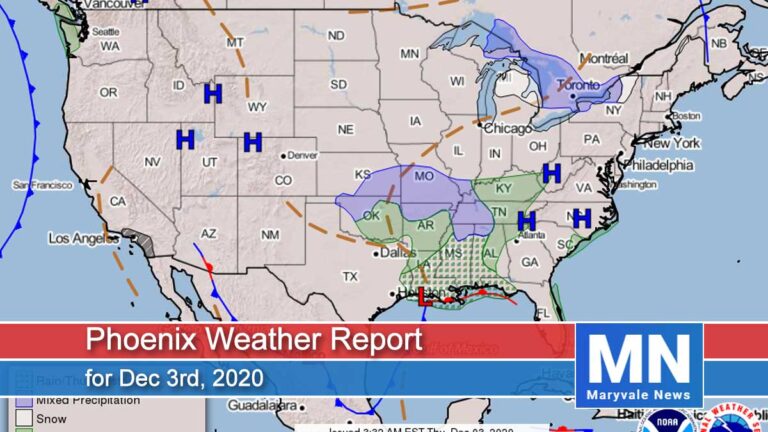
Phoenix Weather Report for Nov 19th, 2020
Forecaster: Henz, D.
As expected we set another high temperature record out at Sky Harbor yesterday reaching 89˚F, but thankfully we did manage to end the streak of 90s. Moving ahead, high pressure will remain to our south and east with a more progressive upper level pattern in place across the western US.
Several weak/dry disturbances will move across the region this weekend and early next week helping to knock temperatures back towards seasonal normals. Otherwise, plan on an uptick in high clouds later today lasting through Saturday to go along with quiet weather conditions.
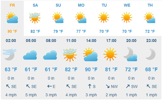
For today plan on clear skies through early afternoon before some passing high clouds into this evening. Afternoon temperatures will climb into the 86˚F-88˚F range around the Valley (Record is 88˚F, set back in 2007).
Variable winds will hover in the 2-8mph range with no noteworthy gusts. Overnight lows will dip into the low 60s to upper 50s around the urban corridor with passing high clouds and light winds.

For tomorrow plan sunny conditions early on before overcast skies into the afternoon/evening. Daytime highs will warm into the 84˚F-86˚F range around the Valley. Variable winds will again hover in the light category with no gusts of any consequence. As highlighted above, plan on dry and quiet weather conditions over the upcoming weekend.
There will be lingering high clouds on Saturday with highs in the low 80s and before sunnier conditions on Sunday with similar highs. Further cooling is expected early next week with daily highs falling back into the upper 70s. More on this to come.
Air Quality Forecast
ADEQ Meteorologist: M. Pace
The high temperature yesterday in Phoenix came in at 89 degrees, which broke the record high for the day of 88 degrees, but at least it was below 90!
Overall, not much change in the weather story through the first part of the weekend, with forecast high temperatures in the mid-80s. The only noticeable difference will be some added clouds Friday into Saturday, but no rain is in the forecast. Sunday into the first part of next week, several disturbances will move through the region, allowing afternoon high temperatures to lower back into the 70s by Monday.
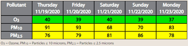
With light winds continuing, we are expecting PM-10 and PM-2.5 to be in the upper Moderate AQI category each day, with the highest concentrations during the late evening and morning hours.