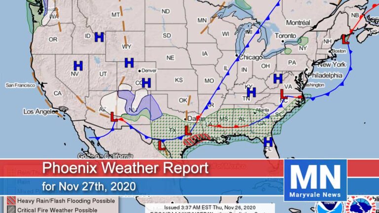
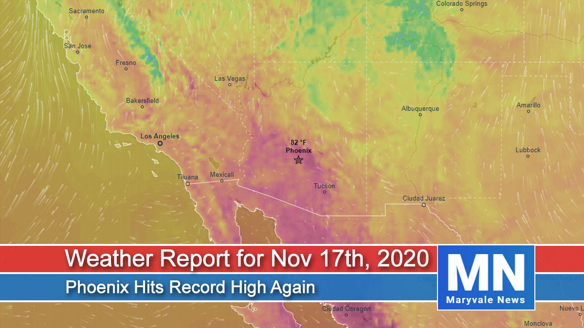
Weather Report for Nov 17th, 2020
Forecaster: Henz, D.
As you may have seen, we set a new daily high-temperature record yesterday out at Sky Harbor of 92˚F. This also set the record for the latest 90˚F+ day in Phoenix and it’s not done.
The high-pressure system will remain in place across the Desert Southwest through Thursday promoting well above normal temperatures and several more chances to break heat records. The ridge is not expected to break down by this weekend and then likely return to the 70s.

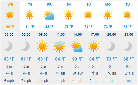
For today’s weather forecast you should plan on mainly sunny skies across the region. Afternoon temperatures will climb into the 88˚F-91˚F range around the Valley (Record is 87˚F, set back in 2008). Morning easterly winds will ease back into the light category (3-10mph range) this afternoon/evening. Overnight lows will again dip into the low 60s around the urban corridor with outlying communities reaching the 50s.
For tomorrow plan on mostly sunny skies with a few passing high clouds. Daytime highs will warm into the 87˚F-89˚F range around the Valley (Record is 88˚F, set back in 2008). Variable winds will hover in the 2-7mph range with no noteworthy gusts to contend with throughout the day. Moving ahead daily temperatures will continue to slowly trend down through the end of the work week towards the mid 80s before a bigger reprieve this upcoming weekend. We’ll also see an uptick in passing high clouds on Thursday and Friday.
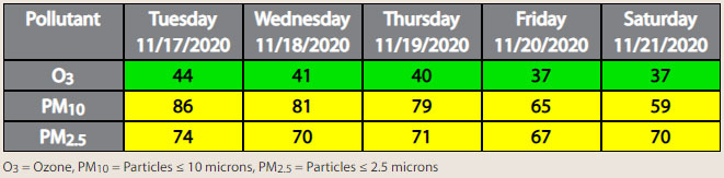
Air Quality Forecast
If you stepped outside yesterday afternoon, you probably felt that something wasn’t quite right weather-wise for the middle of November. The high temperature at Phoenix Sky Harbor topped out at 92 degrees, which was 17 degrees above average! This high also broke the record for the latest 90, 91, and 92-degree day. And last but not least, it broke the record high for the day of 89 degrees set back in 1999.
So what about today? The high has weakened slightly over the state due to a trough moving inland across the Pacific Northwest, so it shouldn’t be as hot as yesterday. With that said, afternoon high temperatures are still forecast to be in the 89 to 90-degree range. The record high for the day is 87, so it is very likely that this will be another record-setting day.
The high will continue to slowly shift eastward through Friday, which will result in a slow cooling trend. A trough is forecast to brush through the state Saturday, with a stronger system on Monday, helping to drop high temperatures back into the 70s Saturday through the first part of next week.
This week’s main concern with air quality will be high PM-10 (dust) and PM-2.5 (smoke) concentrations during the morning and overnight hours due to stagnant conditions allowing local dust and smoke production to buildup. Forecasting both PM-10 and PM-2.5 to be in the Moderate AQI category through the forecast period, with ozone remaining in the Good AQI category.