Weather Report for Nov 16th, 2020
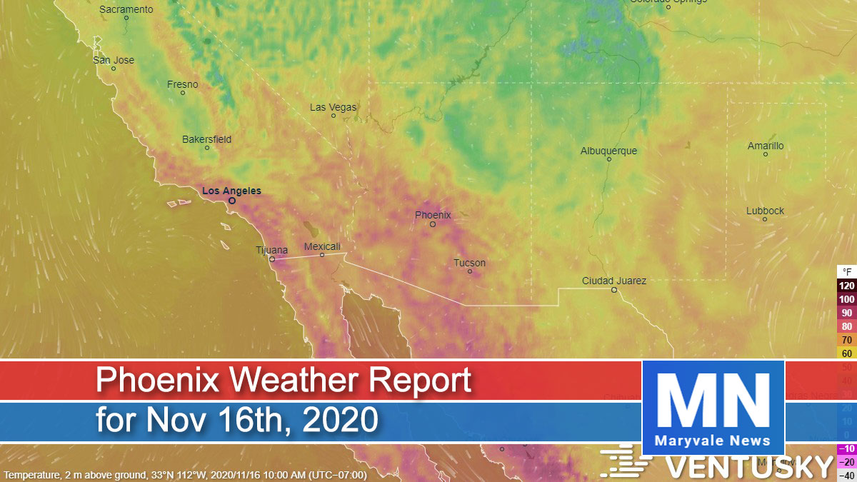
Well, it looks like we’re going record hunting again with unseasonably warm temperatures to start off the week. Looking at the big picture, general ridging (high pressure) will remain in place across the Desert Southwest through Wednesday/Thursday promoting dry conditions and plenty of sun.
Daily high temperatures are forecast to peak in the upper 80s to low 90s each day during the period, which will likely result in several new daily high temperature records for Phoenix. If we happen to reach 90˚F, it would be the latest occurrence on record. Looking ahead, we do expect temperatures to trend back down late week/over the upcoming weekend.

For today plan on clear and sunny skies across the region. Afternoon temperatures will climb into the 88˚F-91˚F range around the Valley (Record is 89˚F, set back in 1999). Breezy morning east winds will give way to light and variable (2-7mph range) conditions this afternoon/evening. Overnight lows will dip into the low 60s around the urban corridor with outlying communities reach the 50s under clear skies.
For tomorrow plan on a near repeat of today with hot temperatures and plenty of sun. Daytime highs will reach into the 88˚F-91˚F range around the Valley (Record is 87˚F, set back in 2008).
We’ll see another round of breezy morning conditions, especially across our far eastern and northern zones before winds ease back into the light category by the afternoon. Well above average temperatures will continue on Wednesday and Thursday with highs remaining in the upper 80s to go along with dry conditions and quiet weather.
Air Quality Forecast
Water vapor satellite shows one thing for Arizona: high pressure is building back in. This pattern will mean mainly clear skies and record to near-record high temperatures for the next several days. The forecast high today in Phoenix is sitting right at 90 degrees, which would not only break the record high for the day of 89, but it would also break the record for the latest 90-degree day on record. The current record stands at November 15th, set back in 1999. Forecast high temperatures will stay in the upper 80s through at least Thursday, which would mean a broken or tied record each day.
By Thursday into the weekend, a broad trough is forecast to move into the West Coast, weakening the area of high pressure and pushing it further toward the southeast. A stronger trough is expected to move through the state Saturday and again early next week, which will help lower temperatures back into the 70s this weekend. Sadly, these troughs will move through dry, so still no rain in the forecast.
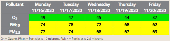
As for air quality, with light winds and stronger morning inversions through the week, forecasting both PM-10 and PM-2.5 to be in the Moderate AQI category, with the highest concentrations in the morning and evening hours. Ozone will be running above average for this time of year but still forecasting it to remain in the upper Good AQI category.